
Mapping the quality of public transportation in Germany
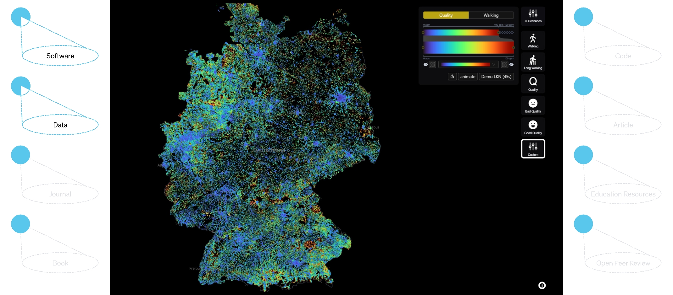
How good is the public transportation from your home address? For an objective perspective, you can check the interactive "Mobility Maps" for Germany that are freely available online. The maps show the accessibility and quality of public transportation for each house in Germany.
For example, the maps can be used to check the situation around a current home or at various potential locations for a new one. In addition to this, the maps provide a valuable tool for data-driven simulations and political decisions, e.g. about the effects of transportation planning activities and potential structural reforms in Germany.
The interactive maps are based entirely on analyses using open-access data. The mapping system was created under the leadership of Daniel Keim and Maximilian Fischer in the Data Analysis and Visualization (DBVIS) research team at the University of Konstanz and funded in the context of the Cluster of Excellence “Collective Behaviour”.
The interactive ‘Mobility Maps’ of Germany are freely available online.
The results dataset underlying the maps (doi: 10.5281/zenodo.14772646) is freely available on Zenodo.